18 November 2010
Connecticut Metro Map
As a companion piece to the Hartford Metro Map, I put together an imaginary metro system for the entire state of Connecticut in the celebrated Modernist style of Massimo Vignelli.
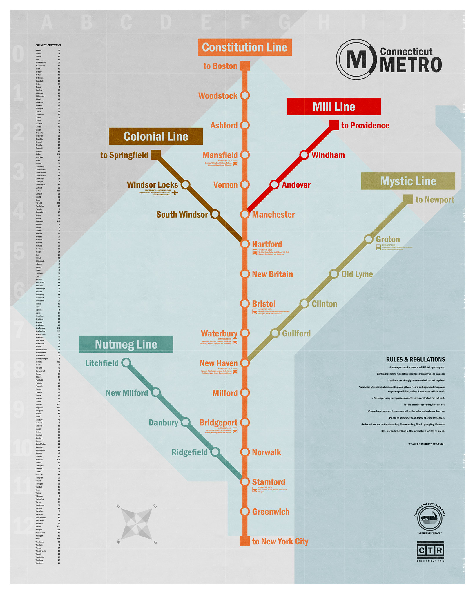
The state is rotated counterclockwise, its contours are smoothed into basic shapes and major cities are nudged to fit along the main southwest to northeast artery, dubbed the Constitution Line. Other corners of the state are served by the Colonial, Nutmeg, Mill and Mystic Lines.